The AlphaUni 20 is a cost-effective and multi-platform mobile mapping system. It is the result of six years of innovation and product development powered by CHCNAV’s state-of-the-art LiDAR technology. In airborne scenarios, the AU20 delivers superior data and improves survey efficiency thanks to its exceptional vegetation penetration capability, extended measurement range, high accuracy, and data density. The AU20’s unique, flexible installation design, coupled with CHCNAV’s LiDAR technology, ensures the best combination of point cloud density, accuracy, and quality. The system provides accurate point cloud and immersive panoramic imagery optimized for a variety of applications, including road surfaces, highway maintenance, and asset management through vehicle-based surveying. Mobile mapping has never been more flexible with the AU20, democratizing the reality capture industry and making it accessible to all.
Main Features
- Long-range LiDAR scanning of up to 1450 m, along with extremely high-speed scanning of 2 million points per second and scanspeeds of up to 200 scans per second
- Extremely high quality point cloud with low range noise
- Strong vegetation penetration, up to 16 target echoes, ability to easily generate real DEM, DSM in challenging conditions
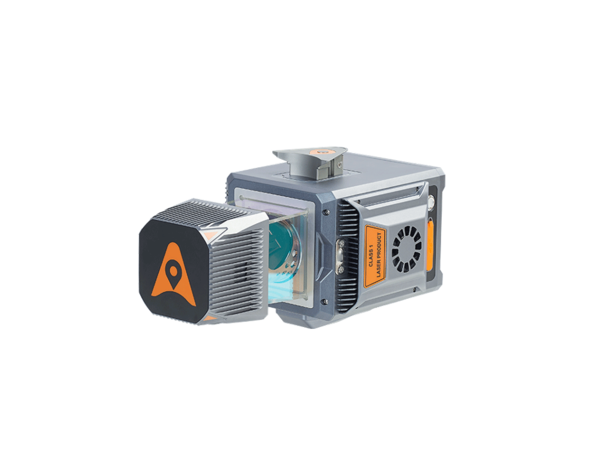
- Various imaging systems to support different platform setups, including full-frame camera for high-accuracy UAV LiDAR+Imaging
- AlphaPano vehicle installation platform, which include panoramic camera and SLAM scanner integration for optimized position in GNSS challenging environment
- Simple setup on various platforms, including crewed aircrafts, drones, vehicles, marine vessels, and even backpack
- All-in-one processing software, including strip adjustment and orthomosaic, as standard features