
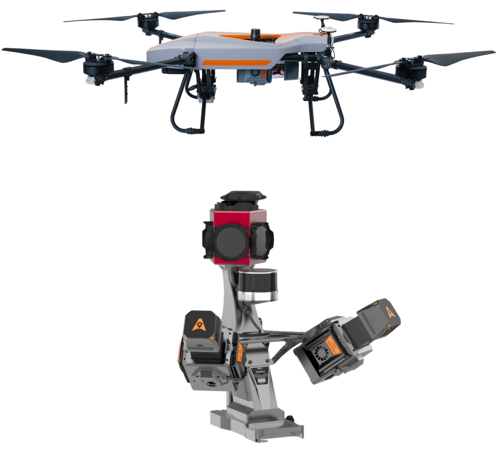
AlphaUni 20
Multi-Platform High-End LiDAR Solution
A new generation of high-end cost-effective multi-platform LiDAR solution, providing best combination of point cloud density, precision, and survey-grade accuracy
- Long-range LiDAR scanning of up to 1450 m, along with extremely high-speed scanning of 2 million points per second and scanspeeds of up to 200 scans per second
- Extremely high quality point cloud with low range noise
- Strong vegetation penetration, up to 16 target echoes, ability to easily generate real DEM, DSM in challenging conditions
- Various imaging systems to support different platform setups, including full-frame camera for high-accuracy UAV LiDAR+Imaging
- Simple setup on various platforms, including crewed aircrafts, drones, vehicles, marine vessels, and even backpack
- AlphaPano vehicle installation platform, which include panoramic camera and SLAM scanner integration for optimized position in GNSS challenging environment
- All-in-one processing software, including strip adjustment and orthomosaic, as standard features
- Ideal for road and rail infrastructure mapping, digital twin, utility and asset management
Key Specifications
Laser Scanner
| range precision | 5 mm (1σ @150m) |
| range accuracy | 15 mm (1σ, @150 m), 5 mm (1σ, @30 m) |
| Laser beam divergence | 0.032° @1/e2 (56mm @100m) |
| field of view | 360°, selectable |
| scan rate | 2,000,000 pts/sec (maximum) |
| number of returns | up to 16 |
| scan speed | up to 200 scans/sec |
| angular resolution | 0.001° |
Imaging System (UAV)
| camera type | full frame |
| resolution | 45 MP (8184 x 5460) |
| sensor/pixel size | 36 x 24 mm/ 4.4 μm |
| focal length | 21 mm / 35 mm |
| field of view (FOV) | 81.2° x 59.5° / 53.4° x 37.8° |
Imaging System (Ladybug 6)
| camera type | 360° Spherical camera, additional adjustable external cameras as option |
| numbers of camera sensors | 6 sensors |
| resolution | 72 MP (12 MP × 6 sensors), 15 FPS JPEG compressed |
| CCD size | 12,288 × 6144 |
| lens | 6.94 mm |
| Coverage | 90% of full sphere |
Positioning and Orientation
| GNSS | multi-constellation, triple-frequency, L-Band |
| IMU | high-precision, user selectable up to 600 Hz |
| POS accuracy (no GNSS outage) | Horizontal: 1 cm (RMS) Vertical: 2 cm (RMS) Pitch/Roll 0.005 degrees (RMS) Heading 0.010 degrees (RMS) |
General System Performance
| Absolute accuracy | < 0.025 m RMS @ 30 m range < 0.050 m RMS @ 150 m range (without control points for UAV, or DMI for mobile scanning) |
| Total system weight | 2.82 kg / 3.12 kg (with C5 camera) 10.97 kg AlphaPano vechicle platform |
| Operating temperature | -20 °C to +50 °C |