
GNSS Receivers

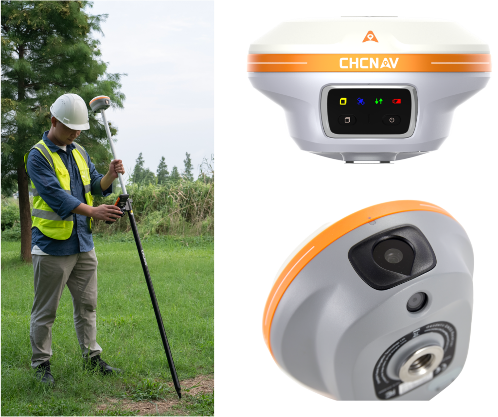
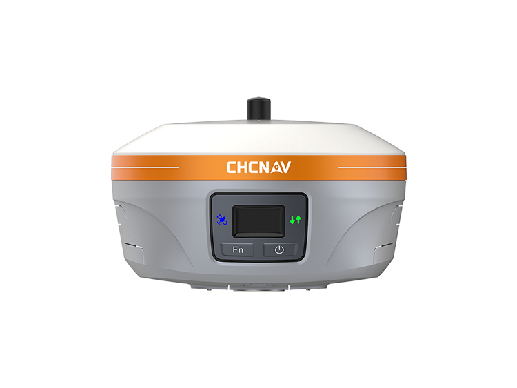
i93 Visual IMU-RTK GNSS
Versatile, high-end GNSS RTK receiver, which integrates GNSS, IMU, and two premium cameras, featuring:
- 1408 channels, and tracks all GNSS constellations and frequencies
- built-in hybrid engine and proprietary narrowband interference mitigation technique
- high-end auto-IMU, which enables automatic pole-tilt compensation in real time, eliminating the hassle of manual initialization, and simplifies surveying operations in the field
- accurate visual positioning through innovative video photogrammetry, which simplifies point measurements and facilitates surveying in hard-to-reach, signal-obstructed, and hazardous locations
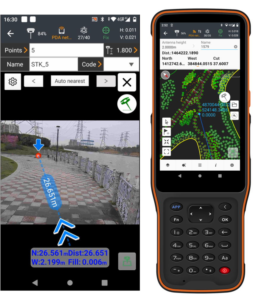
- immersive 3D visual stakeout experience, boosting efficiency and productivity
- accurate and complete 3D models of structures through fusion of drone-based oblique imagery and i93-generated images
i89 Pocket-Sized Visual IMU-RTK GNSS
Lightest dual-camera visual RTK receiver, the i89 brings together superior GNSS performance, Augmented Reality and 3D Modeling in an all-in-one receiver!
- Compact, only 750g, integrating the latest GNSS, high-end IMU and visual technologies for a more compelling user experience
- 1408 channels, tracks all GNSS constellations and frequencies, and employs anti-interference technology
- Automatic pole-tilt compensation in real time, thanks to its high-end IMU
- AR visual navigation and visual stakeout, providing an immersive 3D visual stakeout experience and allowing for quick job completion
- Video photogrammetry algorithms for building and facade 3D modeling, enabling precise 3D modeling of structures
- Seamless integration of UAV and i89 data for efficient and accurate 3D modeling, overcoming typical distortions associated with drone-mounted cameras
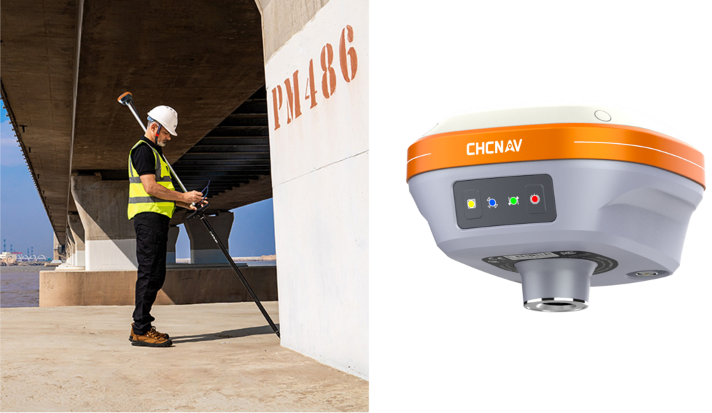
i83 PRO IMU-RTK GNSS
Multi-band IMU-RTK GNSS receiver built for surveying, construction, and mapping professionals:
- advanced GNSS technology, including CHCNAV’s iStar algorithm and Trimble RTX and Omnistar options
- built-in 200 Hz auto IMU sensor for accurate measurements with up to a 60° pole tilt, making it faster and easier to perform surveying tasks while maintaining a high level of accuracy
- advanced integrity features, including Fault Detection & Exclusion (FDE) and Receiver Autonomous Integrity Monitoring (RAIM), which improve position quality by identifying and mitigating satellite errors
- built-in Wi-Fi, Bluetooth, 4G, and UHF modems, and features multiple GNSS survey modes, including RTK networking, UHF base rover configurations, and continuous RTK corrections
i83 IMU-RTK GNSS
Smart and versatile IMU-RTK GNSS receiver for even more intuitive real-time centimeter-level positioning accuracy, featuring:
- 1408 channels, and tracks all GNSS constellations and frequencies
- built-in calibration-free IMU sensor for automatic pole tilt compensation, which boosts surveying, engineering, and mapping speed and efficiency by up to 30%
- built-in connectivity modules, including Bluetooth, Wi-Fi, NFC, 4G, and UHF radio modem
- smart power management technology, which allows for up to 18 hours of continuous RTK rover operation
- unparalleled productivity for GNSS measurements, stakeout surveys, and other surveying, mapping and construction tasks
i73+ IMU-RTK GNSS
Compact, highly rugged and reliable base and rover IMU-RTK GNSS receiver for maximum flexibility, featuring:
- 1408 channels, and tracks all GNSS constellations and frequencies
- built-in transceiver radio module compatible with major radio protocols, making it the perfect choice for a portable built-in UHF base and rover kit
- highly productive NTRIP rover when used with a handheld controller or tablet and connected to a GNSS RTK network via CHCNAV LandStar field software
- built-in interference-free IMU for automatic pole tilt compensation, which increases the efficiency of point measurement by 20% and stakeout by 30%
- ultra-compact, weighing only 730 grams including battery, making intensive field surveys more convenient
iBase GNSS
Integrated, rugged and reliable all-in-one GNSS base station for ultimate ease of use, featuring:
- all GNSS constellations with 1408 channels and advanced multipath mitigation
- rugged conception for uninterrupted work, regardless of the working environment
- Increased performance with 50% less power consumption
- built-in connectivity modules, including Bluetooth, Wi-Fi, NFC, 4G, and UHF radio modem
- various data format, including RTCM 3.x for differential GNSS corrections, RINEX, NMEA 0183, NTRIP Client, NTRIP Caster
Data Collectors
HCE600 Field Data Collector
Ultra-rugged Android data collector with an alphanumeric keypad for surveying, mapping and construction applications
- high performance, Android-based handheld controller with eight-core processor
- built-in connectivity modules including Bluetooth 5.0, dual-band Wi-Fi, 4G cellular modem
- ultra-rugged and ultra-lightweight (only 345 g), ergonomically-designed, handheld data collector for surveying and mapping applications
- high-brightness 5.5-inch HD+ display, easily readable for operations in all weather conditions, whether in direct sunlight or on a rainy day
- all-day battery life provides uninterrupted data collection in the field
Software
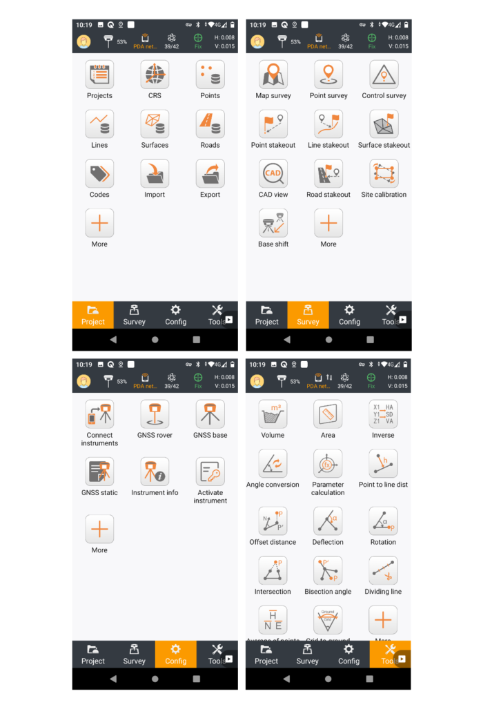
LandStar 8 – Data Collection Application
Easy to use, field-proven data collection application for Android devices as well as CHCNav data controllers
- built around easy-to-use workflow management and an intuitive graphical interface designed to help efficiently complete high-precision surveying and mapping projects
- modular design, allowing the user interface to be customized to meet specific user needs and make deployment to field crews easy and highly efficient
- advanced graphics rendering of mapping projects in LandStar 8 provides users with an unprecedented field experience
- simplified project and coordinate system management, including custom coordinate systems, geoid models, and codification libraries
- integrates all surveying features for different applications, including construction, surveying, control point measurement, native CAD project support, fast and accurate points, lines and surfaces stakeouts, road construction, GIS data acquisition, and more
- comprehensive industry-standard data import and export formats
- cloud integration enables efficient collaboration from field to office
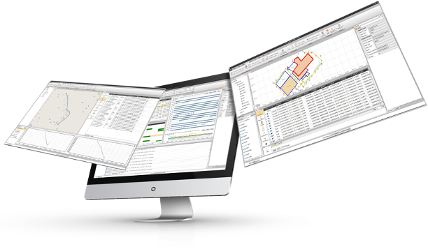
Geomatics Office Software
All-in-one, easy-to-use office software to edit, process and analyze raw GNSS data to obtain high accuracy positions
- supports raw GNSS data from all GNSS constellations, in static, fast static, post-processed kinematic (PPK), and precise point positioning (PPP) modes
- supports multiple observation file formats, predefined coordinate systems and various manufacturer antenna types
- offers a large library of geodetic tools including coordinates and RINEX converters, TIFF map compressor (SIT), angle, distance and volume calculator, GNSS antenna manager and GNSS observation files splitter and merger
- ideal for geodetic applications, surveying, UAV trajectory and ground control points (GCPs) and road construction applications