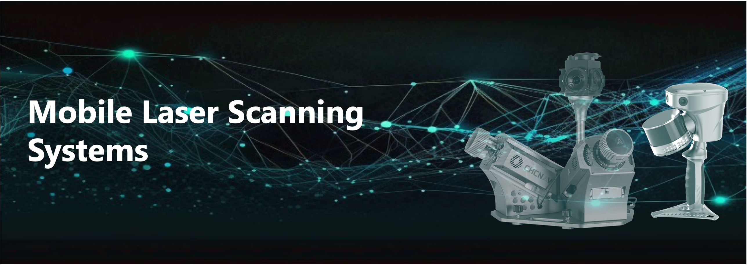
AlphaUni 20
Multi-Platform High-End LiDAR Solution
A new generation of high-end cost-effective multi-platform LiDAR solution, providing best combination of point cloud density, precision, and survey-grade accuracy
- Long-range LiDAR scanning of up to 1450 m, along with extremely high-speed scanning of 2 million points per second and scanspeeds of up to 200 scans per second
- Extremely high quality point cloud with low range noise
- Strong vegetation penetration, up to 16 target echoes, ability to easily generate real DEM, DSM in challenging conditions
- Various imaging systems to support different platform setups, including full-frame camera for high-accuracy UAV LiDAR+Imaging
- AlphaPano vehicle installation platform, which include panoramic camera and SLAM scanner integration for optimized position in GNSS challenging environment
- Simple setup on various platforms, including crewed aircrafts, drones, vehicles, marine vessels, and even backpack
- All-in-one processing software, including strip adjustment and orthomosaic, as standard features
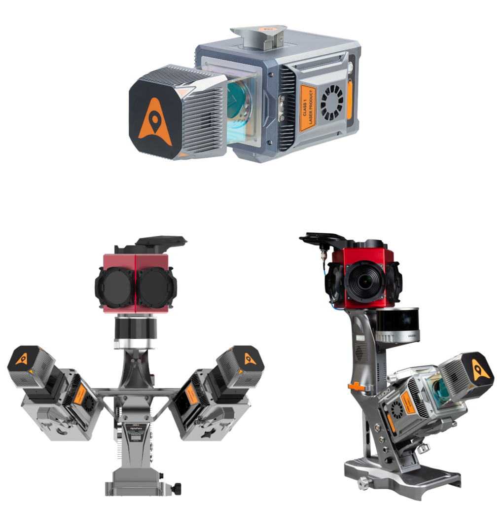
Alpha 3D – Dual
High Performance 3D Mobile Mapping Solution
Alpha3D combines an advanced long-range, high-speed, precise laser scanners, a high-resolution HDR panoramic camera in combination with cutting-edge GNSS receiver and ultra-high-precision IMU
- Cutting-edge, dual-head Riegl VUX-1HA22 scanner system with up to 500 scans/sec, up to 1.8 million points/sec for each laser head, and 360° FOV (full circle)
- 30 MP HDR panoramic camera for point cloud colorization or separate photogrammetry data analysis
- Optional additions include GAMS, DMI sensor, second GNSS antenna
- Optional single laser head
- Vehicle independent, simple mounting solution, suits road, rail and water-based applications
- Simple and intuitive browser-based mission setup and automatic data collection, supporting any operation system on any smart device or laptop
- All-in-one processing software, including automated point cloud processing, image georeferencing, point cloud colorization, and results reports
- Ideal for road and rail infrastructure mapping, digital twin, utility and asset management
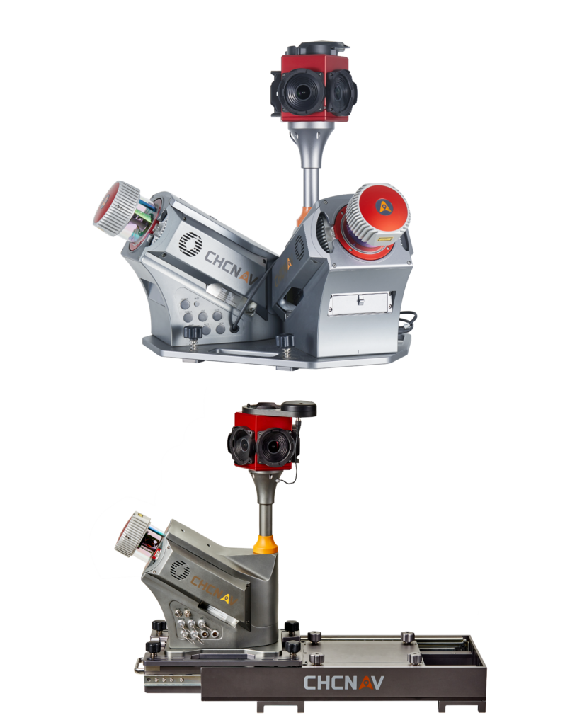
RS10
A revolutionary handheld SLAM 3D Laser Scanner + GNSS RTK
The RS10 brings a new approach to surveying and mapping by integrating GNSS RTK, IMU, laser scanning, and visual SLAM technologies into a single platform designed to improve the efficiency and accuracy of surveying tasks and indoor and outdoor 3D scanning
- Enables real-time cm-level georeferenced point cloud, both indoor and outdoor. Users receive instant feedback, allowing them to ensure complete and detailed coverage
- Through the Vi-LiDAR technology, the RS10 offers a new mode of RTK surveying, which combines GNSS rover capabilities with laser scanning for contactless offset measurements.
- For surveying urban canyons and indoor spaces where GNSS signals are weak or absent, the RS10 calculates accurate RTK point coordinates, ensuring less than 5 cm precision within 1 minute in satellite-denied environments, opening up new possibilities for ubiquitous mapping
- Provides a seamless workflow for surveying projects spanning outdoor and indoor spaces – all within the same coordinate system without requiring additional georeferencing steps
- Eliminates the need for traditional loop closure, which enables users to scan target areas without having to return to previous locations. This streamlines field data capture and significantly reduces the time spent in the field
- Can be used as a handheld, wearable scanner or can be mounted on a pole, an ATV or a backpack
- Ideal for surveying, construction, digital twin, mining, forestry, and data collection in underground