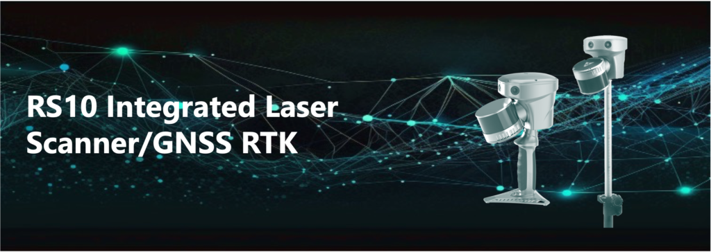
RS10
A revolutionary handheld SLAM 3D Laser Scanner + GNSS RTK
The RS10 brings a new approach to surveying and mapping by integrating GNSS RTK, IMU, laser scanning, and visual SLAM technologies into a single platform designed to improve the efficiency and accuracy of surveying tasks and indoor and outdoor 3D scanning
- Enables real-time cm-level georeferenced point cloud, both indoor and outdoor. Users receive instant feedback, allowing them to ensure complete and detailed coverage
- Through the Vi-LiDAR technology, the RS10 offers a new mode of RTK surveying, which combines GNSS rover capabilities with laser scanning for contactless offset measurements.
- For surveying urban canyons and indoor spaces where GNSS signals are weak or absent, the RS10 calculates accurate RTK point coordinates, ensuring less than 5 cm precision within 1 minute in satellite-denied environments, opening up new possibilities for ubiquitous mapping
- Provides a seamless workflow for surveying projects spanning outdoor and indoor spaces – all within the same coordinate system without requiring additional georeferencing steps
- Eliminates the need for traditional loop closure, which enables users to scan target areas without having to return to previous locations. This streamlines field data capture and significantly reduces the time spent in the field
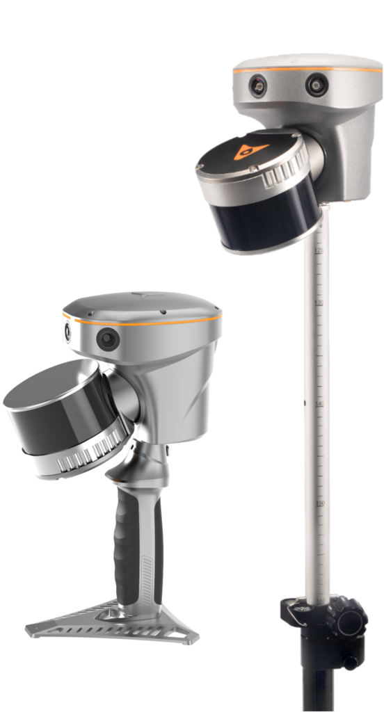
- Can be used as a handheld, wearable scanner or can be mounted on a pole, an ATV or a backpack
- Ideal for surveying, construction, digital twin, mining, forestry, and data collection in underground
Key Specifications
Laser Scanner
| Scanner | 32 Channels (16 also available) |
| Laser classification | Class 1 eye safe |
| Range precision | 5 mm (1σ, typical) |
| Point cloud thickness | 1 cm |
| Max. range | 300 m |
| Range capability | 80 m @10% reflectivity |
| Sensor FOV | 360° (H) × 40.3° (V) |
| Scan rate | 640,000 pts/sec (first or strongest return) |
| Number of returns | 3 |
Imaging System
| Number of cameras | 3 |
| Resolution | 15 MP (5 MP x 3 sensors) |
| Sensor size | 2592 (H) × 1944 (V) |
| Pixel size | 2.0 μm |
| FOV | 210° × 170° |
Positioning and Orientation
| GNSS | multi-constellation, triple-frequency |
| IMU | high-precision with 200 Hz update rate, auto initialization |
| Positioning accuracy (no GNSS outage) | PPK: 3 mm + 1 ppm (H, RMS), 5 mm + 1 ppm (V, RMS) RTK: 8 mm + 1 ppm (H, RMS), 15 mm + 1 ppm (V, RMS) Pitch/Roll 0.005 degrees (RMS) Heading 0.010 degrees (RMS) |
General System Performance
| Relative accuracy | < 1 cm |
| Absolute accuracy | < 5 cm (Horizontal) < 5 cm (Vertical) |
| System field of view | 360° × 270° |
| Weight (including RTK and battery) | 1.7 kg |
| Loop-free data acquisition | Yes |
| Real-time accuracy assessment | Yes |
| Power supply mode | Lithium battery, supports hot-swapping |