Expert Consulting Services
With a dedicated team of experienced professionals, we offer comprehensive consulting services tailored to your unique needs and challenges
Optimize your workflows, gain a competitive edge
From precise GPS/GNSS Surveying to Drone LiDAR/Photogrammetry and Mobile Scanning, our experts will work closely with you to deliver practical solutions that drive efficiency, optimize your workflows, and gain a competitive edge.
What We Offer
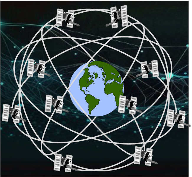
GPS/GNSS solutions
Our expert consultants provide comprehensive GPS/GNSS solutions tailored to your specific needs. Whether you require high-precision positioning for surveying, construction, or precision agriculture, we offer expertise in GNSS technology and applications. We assist with system selection, integration, and optimization to ensure accurate and reliable positioning data for your projects.

Mobile Laser Scanning
Our mobile mapping and scanning consulting services help you harness the capabilities of cutting-edge mobile laser scanning systems. We guide you in integrating various sensors, including GNSS, inertial measurement units (IMUs), LiDAR scanners, and high-resolution cameras, onto mobile platforms. Our experts assist with system setup, calibration, data acquisition and processing, enabling you to capture detailed spatial information for transportation, infrastructure, energy and utilities, asset management projects, and more.
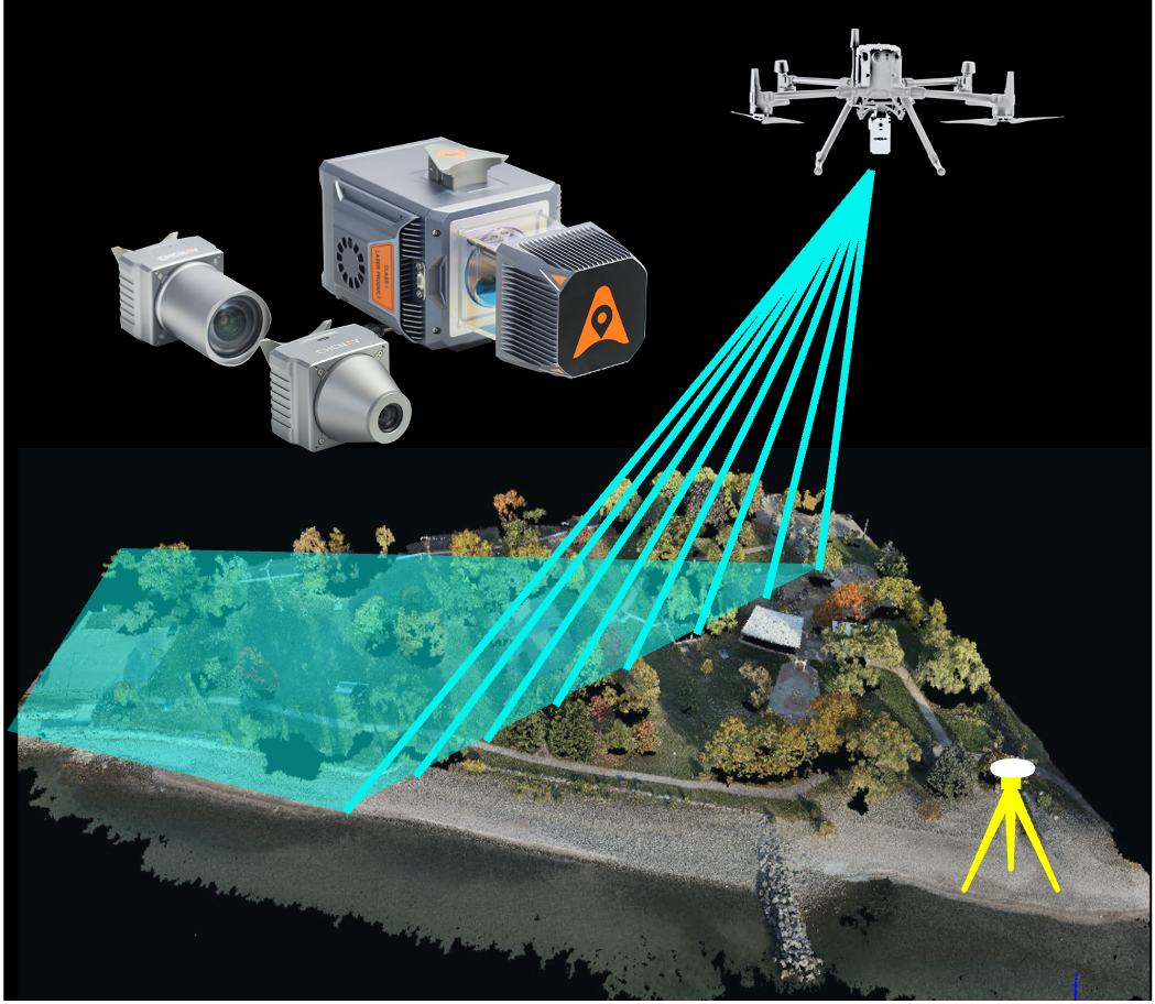
Drone Mapping
Leverage the power of drones for efficient mapping and surveying. Our consultants are skilled in utilizing drones for aerial data acquisition, enabling you to capture high-resolution RGB and multi-spectral imagery, LiDAR point clouds, thermal data, and more. We provide guidance on drone selection, flight planning, and data acquisition. We also offer expertise in data processing and 3D modeling, allowing you to create detailed maps, orthophotos, and digital terrain models for a wide range of applications.
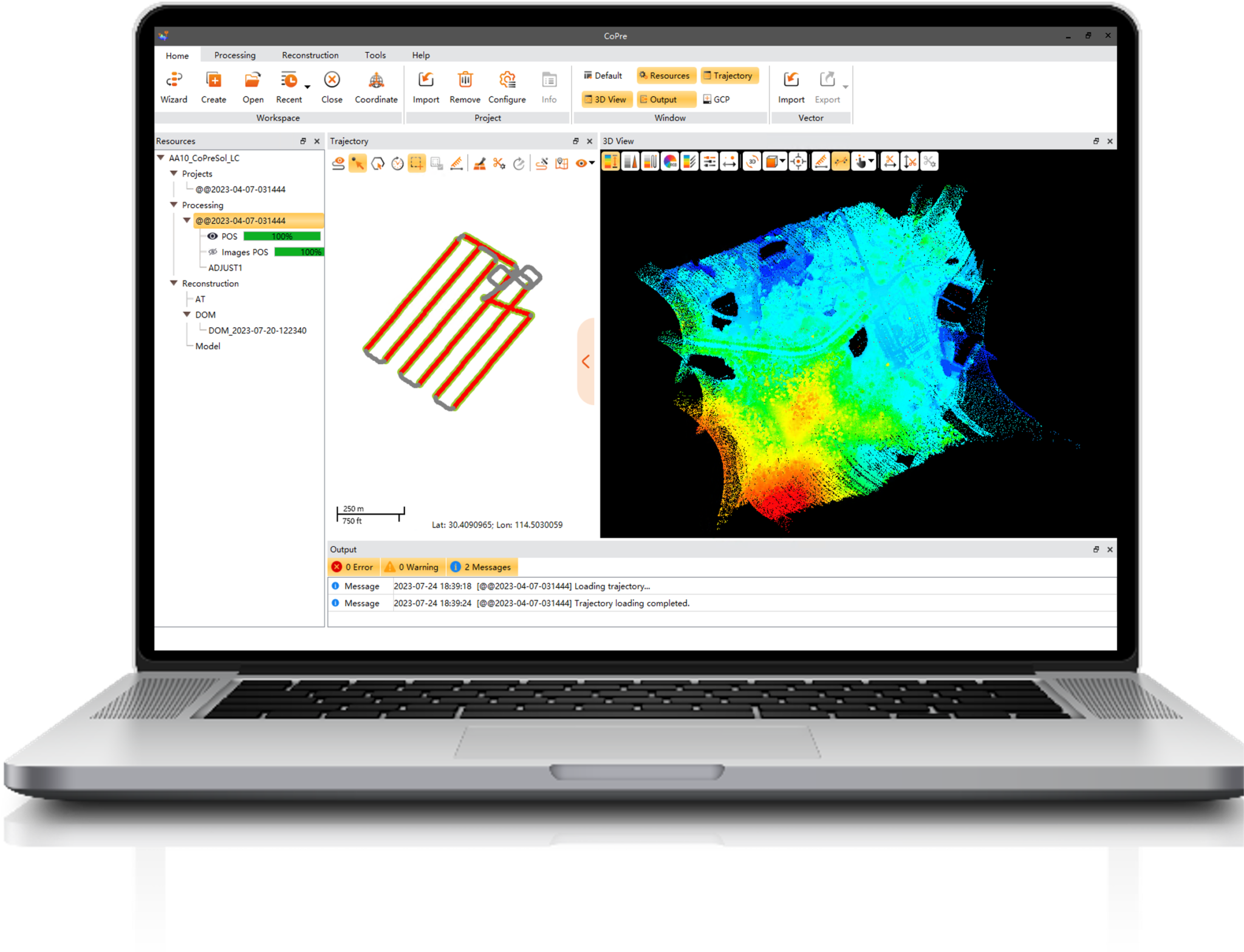
Data Processing and Analysis
Our consultants have extensive experience in handling large-scale geospatial datasets acquired from GNSS receivers, drones-based LiDAR and imaging, and mobile laser scanning systems. We help you employ advanced processing techniques, including point cloud generation and classification, feature extraction, and geospatial analysis, to unlock the full potential of your data. We also provide guidance on rigorous quality checks, including accuracy assessments, data validation, and error analysis.

Workflow Optimization
Optimize your geospatial workflows with our consulting services. We assess your existing processes and identify opportunities for improvement, and propose tailored solutions to optimize data collection, processing, and analysis. We also provide comprehensive training programs to empower your team with the necessary skills and knowledge to effectively utilize GNSS, drones, and mobile laser scanning technologies. Our training courses cover topics such as data collection techniques, data processing software, and best practices for accurate and efficient geospatial workflows.