
We believe that knowledge is the key to unlocking the full potential of geospatial technology
Our training programs are designed to equip individuals and teams with the skills and expertise needed to excel in the field. Whether you’re a beginner or an experienced professional, our certified trainers, drone pilots, and instructors will guide you through hands-on field training and interactive courses.

Through practical exercises, real-world case studies, and interactive learning,
our comprehensive training courses cover topics such as GPS/GNSS Surveying, Drone LiDAR and Photogrammetry, Mobile Laser Scanning, and more.
Explore our Training Courses

Fundamentals of GPS/GNSS
Master the fundamentals of Global Navigation Satellite Systems (GNSS) through this two-day course. Learn about GPS and multi-constellation GNSS systems, datums and coordinate systems, satellite orbits, GNSS signals and error sources and mitigation techniques. Explore emerging trends in GNSS receivers and acquire details about positioning techniques, communication links, and GNSS correction services. Gain practical skills in data collection, processing, and analysis to achieve accurate positioning results for surveying, 3D mapping, and scanning applications.
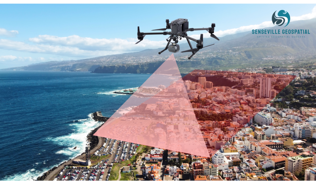
Drone Photogrammetry and 3D Mapping
Unlock the power of drone photogrammetry and 3D mapping through our specialized training courses. Learn the fundamentals of drone safety regulations, mission planning and best practices. Gain fundamental knowledge about sensors and Photogrammetry techniques. Acquire the skills to capture high-quality imagery, and process drone data using Photogrammetry software to generate point clouds from drone imagery, orthomosaics, and digital surface models (DSMs) for visualization, analysis, and mapping applications.
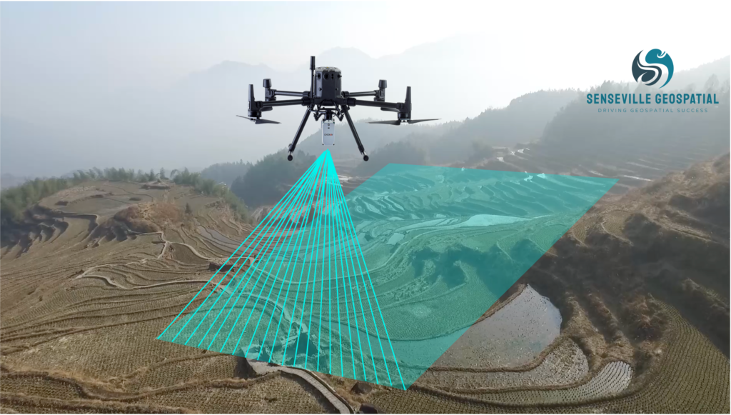
Drone LiDAR and Photogrammetry
Combining LiDAR and Photogrammetry has the potential to overcome the drawbacks of each technology alone! In this specialized course, you will learn the concept of drone-based laser scanning, Photogrammetry,and multi-sensor integration. You will also learn the fundamentals of drone safety regulations, mission planning, system calibration, and best practices. Additionally, the course will cover topics such as drone and payload selection, as well as data collection, processing and analysis, and final product generation for various applications.
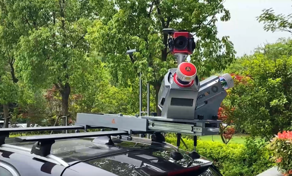
Mobile Laser Scanning
Explore the world of mobile laser scanning and mapping technologies through our hands-on training courses. Learn how to effectively utilize and integrate vehicle-mounted GNSS, inertial measurement unit (IMU), LiDAR scanners and imaging sensors for mobile data collection. Gain hands-on experience with mobile laser scanning hardware and software, including data acquisition techniques, system calibration, and post-processing workflows. Acquire the skills to perform accurate and detailed mobile laser scanning for transportation, infrastructure, and asset management projects.
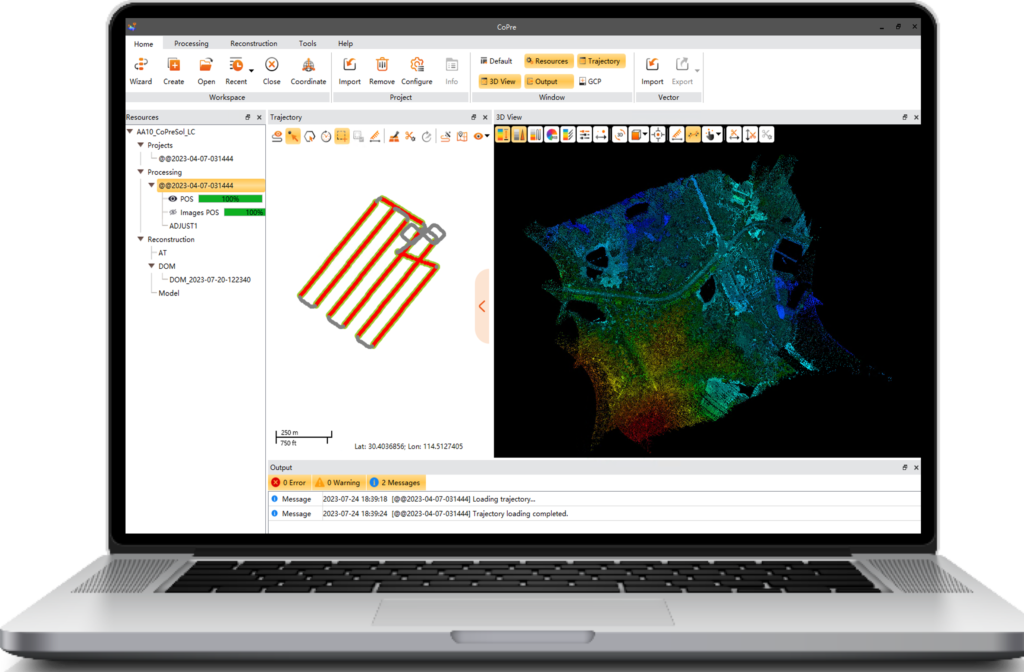
Geospatial Software Training
Become proficient in geospatial software applications used in GNSS, drone, and mobile mapping projects. Our training courses cover popular software platforms, such as GNSS software, Photogrammetry, LiDAR+Photogrammetry, and Reality Capture post-processing software. Learn how to effectively utilize these software packages for data processing, visualization, analysis, and reporting.

Customized Training Programs
We understand that each organization has unique training needs. Our team can work with you to develop customized training programs tailored to your specific needs. Whether you need specialized training on specific software, industry-specific applications, or advanced geospatial techniques, we can design a training program to address your organization’s goals.