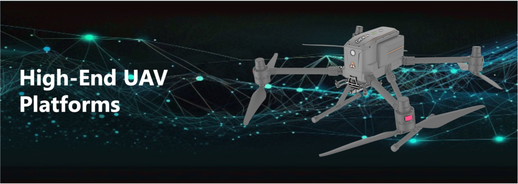
Quadcopter UAV
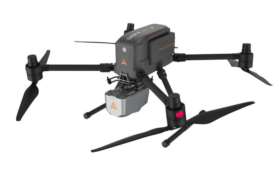
X500 ROTOR UAV
High-performance drone engineered for exceptional payload capacity and endurance
Key features
- Supports a 5 kg payload capacity and offers a flight endurance of 58 minutes, or up to 50 minutes when equipped with the CHCNav AA10 LiDAR
- Features robust redundancy with dual GNSS, triple IMU backups, dual-redundant flight control, and safe return strategies
- Superior maneuverability, stability, and flight performance, thanks to its advanced flight controls and high-precision positioning
- Built-in visual SLAM and obstacle detection radar, ensuring intelligent and safe operations, and enabling landing on moving vehicles and vessels
- Comes with CHCNav SmartGo ground control software, which supports diverse flight path options, including rectangular, strip, polygonal, and facade routes
- Provides real-time updates on the drone’s status, heading, and surrounding obstacles, ensuring enhanced safety for beyond-visual-line-of-sight (BVLOS) operations
- Ideal for applications such as surveying, infrastructure inspection, open-pit mining, urban monitoring, emergency scouting, and disaster relief
Key Specifications
| Drone Type | Quadcopter with 4 propellers |
| Max. Flight Time | 52 minutes with 2 kg payload, 40 minutes with 4 kg payload |
| Max. Payload | 5 kg |
| Cruise Speed | 23 m/sec (82.8 km/hr) |
| Wind Resistance | up to 12 m/sec (43 km/hr) |
| Dimension | 77 × 80.4 × 45 cm (L × W × H), unfolded without propellers |
| Control system | dual GNSS, triple IMU backups, dual-redundant flight control, and safe return strategies |
| Energy system | Intelligent Battery Station; 2 × 10000 mAh intelligent battery; Dual hot-swap batteries |
| Remote controller & SW | 10.1-inch touchscreen; CHCNav SmartGo ground control software |
| Supported payload | CHCNav LiDAR and camera systems; certified third-party devices |
| Operating Temperature | -20°C to +50°C |
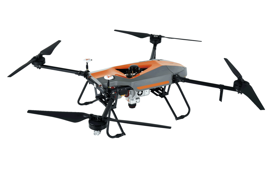
BB4
State-of-the-art professional UAV
Key features
- High-end UAV resulting from an alliance between two industry leaders, CHCNav and DJI
- Superior flying performance, with up to 7 kg payload
- Offers up to 55 minutes of flight time with a 1 kg payload and up to 40 minutes with a 5 kg payload
- DJI Lightbridge 2 flight controller with DJI GS Pro flight software
- Support all CHCNav UAV payloads, as well as third party systems weigh 7 kg or less
- A smaller version, BB4 mini, is also available, with a maximum payload capacity of 3 kg
Key Specifications
| Drone Type | Quadcopter with 4 propellers |
| Max. Flight Time | 55 minutes with 1 kg payload, 40 minutes with 5 kg payload |
| Max. Payload | 7.1 kg |
| Cruise Speed | 14 m/s |
| Wind Resistance | up to 13.9 m/s (50 km/hr) |
| Dimension | 110 × 110 × 44 cm |
| Control system | Dual-frequency GNSS navigation and dual-redundancy sensor design |
| Flight Control System | Dual DJI A3 |
| Remote control SW | DJI GS PRO |
| Takeoff type | Automated takeoff and landing |
| Operating Temperature | -10°C to +40°C |
VTOL Fixed-Wing
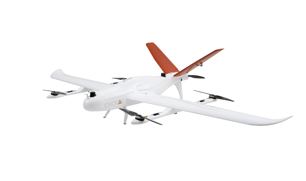
P330 Pro
High-performance vertical takeoff and landing (VTOL) fixed-wing UAV
Key features
- Ultra-efficient aerodynamic design, 150 min endurance and up to 20 km² coverage per flight
- Packed with the latest aviation technologies, triple redundant flight control system and safer operation
- Integrates a high-accuracy GNSS RTK/PPK module that has up to 100 Hz differential data update rate
- Supports a wide range of sensors, including RBG cameras, multispectral cameras, or lightweight laser scanners, and ability to quickly switch between them
- Ideal for mapping highway corridors, surveying open-pit mines, construction, and agriculture
Key Specifications
| Drone Type | Vertical take-off and landing (VTOL) |
| Max. Flight Time | 160 mins (without payload) |
| Max. Payload | 2 kg |
| Cruise Speed | 21 m/s |
| Wind Resistance | up to 12 m/s (43 km/hr) |
| Wingspan | 2.53 m |
| Fuselage Length | 1.21 m |
| Vertical Take-off Height | 50 ~ 200 m |
| Ground Control Software | EasyFly (Windows) |
| Operating Temperature | -20°C to +50°C |